
Market Update · 22 min read
Plant City’s Plan Sends Retail to Three Nodes and Industry East of Park Road
Plant City’s adopted Imagine 2040 plan directs further retail to three activity centers: Alexander Street at James L. Redman Parkway, and the Interstate 4 interchanges at Thonotosassa Road and Park Road. Future industrial land in that plan sits east of Park Road and along County Line Road. Census QuickFacts puts the city at 44,118 on July 1, 2025. BEBR’s April 1, 2025 estimate is 45,331. FDOT’s 2025 telemetered count on I-4 under the Bethlehem Road overpass is 144,159 vehicles a day.

Plant City’s commercial map is already written, and it is a city plan, not a Brandon rent roll. The adopted Imagine 2040 Plant City Comprehensive Plan, posted by the Hillsborough County City-County Planning Commission, sends further retail and service commercial growth to three activity centers and sends the next industrial land east of Park Road and along County Line Road. Census QuickFacts, vintage V2025, counts 44,118 people in the city on July 1, 2025. The University of Florida Bureau of Economic and Business Research counts 45,331 on April 1, 2025. Florida Department of Transportation’s 2025 annual average daily traffic report, run February 19, 2026, counts 144,159 vehicles a day on Interstate 4 under the Bethlehem Road overpass, the telemetered station on the east-county approach to this city.
Those three clocks are the briefing. The plan is the use map. The population estimates are the household base. The traffic report is the road file. A user, a land buyer, or a lender who wants a bay, a dock, or a downtown storefront in Plant City starts with those papers. The Hillsborough commercial overview is the county file. The Brandon and State Road 60 commercial guide is the mall-and-boulevard file to the west. The port and I-4 industrial guide is the cargo belt that runs toward this city from the port. This page is the incorporated city at the east end of that belt. Statewide context stays on Florida markets. The service door is commercial.
The plan’s own map of the city
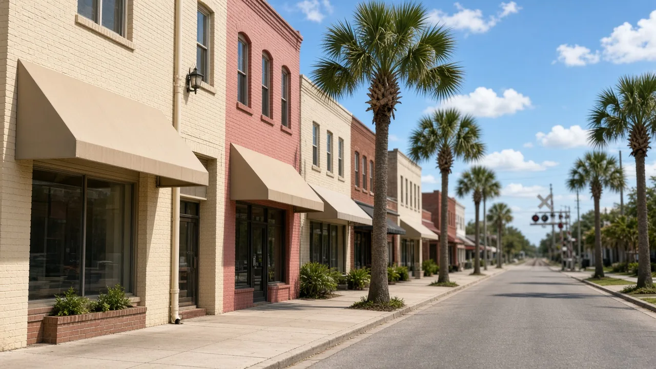
The comprehensive plan’s vision section calls the historic downtown the heart of the city. It places that heart at the intersection of Collins Street and Reynolds Street, where two railroad lines still meet. The plan says those lines are owned and operated by CSX. City Hall sits in that same center. The plan’s sentence is that downtown remains the physical and social center, and that the plan’s own policies are written to keep it there.
The same section names the three major commercial activity centers. One is the intersection of Alexander Street and James L. Redman Parkway. The other two are the Interstate 4 interchanges at Thonotosassa Road and at Park Road. The plan says further commercial development will be directed to these nodes, and that the nodes are expected to continue to meet the majority of retail and service needs of Plant City residents.
A later paragraph lists the interstate commercial frontage more widely. Commercial areas sit at the I-4 interchanges of Thonotosassa Road, Alexander Street, Paul Buchman Highway and Wheeler Street, Park Road, and County Line Road. The plan describes what has already filled those quadrants: gas and service stations, restaurants, automobile dealerships, and hotels. It then says vacant land in those areas will continue to allow additional commercial development near the interstate. A vacant quadrant on a plan map is an allowance. It is not a tenant, a delivery date, or a rent.
Industry is pointed the other direction from the historic storefronts. The plan says the industrial park around Plant City Airport, in the southwest, is near build-out. That park sits north of Sydney Road, south of State Road 574, and west of Alexander Street, on land the city annexed in the early 1970s for industry next to the airport. The plan’s forward sentence puts additional industrial uses in Gregg’s Business Center, also called Lakeside Station Logistics Park, and along County Line Road south of I-4. The city, in that text, encourages industrial uses that are smokeless, odorless, non-toxic, and not a health hazard or a nuisance to adjacent property in Plant City, Hillsborough County, Lakeland, or Polk County.
The loop the plan uses to tie the center together is Alexander Street, Sam Allen Road, and Park Road. The other named corridors are James L. Redman Parkway, Collins Street, Wheeler Street, and Paul Buchman Highway as one north-south chain; Baker Street, which is U.S. 92; Reynolds Street, which is State Road 574; and Interstate 4. Neighborhoods of historical significance sit north and west of downtown. The plan says most existing neighborhoods are at or near build-out, and that the vast majority of future residential growth is expected in the northeastern quadrant, predominantly north of I-4. Policy in that section is written to keep non-residential traffic out of those neighborhoods.
Two population clocks, and the plan’s older projection
Print the vintage before you print the headcount. Census QuickFacts V2025 estimates Plant City at 44,118 on July 1, 2025. The estimates base on that same table is 39,859 on April 1, 2020, and the change from that base is 10.7 percent. The April 1, 2020 Census count on the table is 39,764. The April 1, 2010 Census count is 34,721. Housing units on July 1, 2025 are marked X on that QuickFacts table, so this page does not invent a 2025 unit count. Building permits for 2025 are marked X as well.
The same QuickFacts table, for the 2020–2024 American Community Survey window, prints a residential household file. Households: 14,612. Persons per household: 2.76. Owner-occupied housing unit rate: 66.4 percent. Median value of owner-occupied housing units: $291,800. Median gross rent: $1,409. Persons under 5 years: 5.5 percent. Persons under 18: 24.0 percent. Persons 65 and over: 14.4 percent. Land area in 2020: 27.58 square miles. Population per square mile in 2020: 1,441.8. The owner value and the gross rent are house figures. They are not a pad price, a bay rent, or a cap rate, and this page does not convert them into one.
BEBR’s official April 1, 2025 estimates, published for the state and mirrored by the Florida Legislature’s Office of Economic and Demographic Research, put Plant City at 45,331. The change column from the April 1, 2020 Census count of 39,764 is 5,567. The inmate column is 0. Hillsborough County on that same table is 1,575,637, a change of 115,875 from the 2020 count of 1,459,762. Tampa is 412,684. Unincorporated Hillsborough is 1,089,924. Plant City is a city inside a much larger county. A countywide commercial average would bury it.
The comprehensive plan carries a third population series, and it is older. LU Table 2, sourced to the Planning Commission in 2014, starts from the 2010 Census of 34,721 and projects 40,530 in 2015, 44,146 in 2020, 49,740 in 2025, 64,555 in 2030, 69,113 in 2035, and 71,523 in 2040. The city’s planning-resources page still summarizes that horizon in round numbers: a current population of 42,000-plus expected to increase to over 71,000 by 2040. Read the round sentence as the city’s page. Read 71,523 as the table. Read 44,118 and 45,331 as the 2025 estimates. The plan’s 2020 step of 44,146 landed above the 2020 Census count of 39,764. The plan’s 2025 step of 49,740 sits above both 2025 estimates. The horizon is a planning number from 2014. It is not a 2026 headcount, and it is not an absorption rate for retail space.
The plan’s own community profile, written against the 2010 count, also records the city’s Hispanic or Latino share at 28.8 percent in 2010, up from 17.4 percent in 2000, 8.3 percent in 1990, and 1.5 percent in 1980. That is the plan’s 2010 line. QuickFacts for 2020–2024 prints a different language measure: 28.3 percent of persons age 5 and older speak a language other than English at home. Those are two official sentences from two decades. They describe a city household, not a store’s sales.
What the land inventory and the intensity rules actually allow
Inside the plan’s current community profile, the land inventory prints commercial development at 769 acres, 4.3 percent of the city’s land, at 0 to 0.35 FAR, and industrial development at 1,678 acres, 9.3 percent, at 0 to 0.50 FAR. Residential land in that same table is 4,318 acres, 24.1 percent, at 0 to 20 dwelling units per gross acre. Agricultural land is 4,933 acres, 27.5 percent. The plan also says that in 2014 the city comprised about 17,953 acres, up from about 15,229 acres in 2000. Census land area for 2020 is 27.58 square miles. Keep the acre sentence and the square-mile sentence on their own dates. This page does not average them into a new city size.
The commercial future-land-use category is the working rule for a retail or highway-commercial site. The category description says these areas contain goods and services for residents and businesses, from individual retail and office uses to shopping centers, auto dealerships, mixed-use projects, and governmental uses. Existing agriculture may continue as an interim use. Commercial areas are to be accessed from collectors or arterials. General commercial intensity is up to 0.35 floor area ratio. A separate bullet allows general commercial uses at up to 1.0 FAR in appropriate locations within a quarter mile of intersections of arterials and Interstate 4. Residential density inside the commercial category is up to 16 dwelling units per gross acre, and up to 20 inside the Midtown Redevelopment District through MTD zoning. The category definition repeats the pair of caps: maximum floor area ratios shall not exceed 0.35, and 1.00 within a quarter mile of an interstate interchange.
Light commercial and office is the quieter category. Non-residential uses there are limited to 0.35 FAR. Residential uses are permitted up to 10 dwelling units per acre. The category is written for personal service, small office, and low-intensity retail. Manufacturing, wholesale distribution, warehousing, mini-storage, and outside storage are not the use. New development that is not already commercially zoned is steered to C-1B, C-1C, or a planned development. Frontage is supposed to be on an arterial or a collector, or on a connecting local street that does not pass through a residential area.
Industrial land use, in the plan’s definition, allows up to a 0.50 FAR. Convenience commercial inside an industrial planned development is limited to 10 percent of the industrial building square footage. No new residential development is allowed in that category. The zoning code’s M-1 section matches the intensity: industrial uses are limited to a maximum floor area ratio of 50 percent, with a 35-foot front yard, 25-foot side and rear yards, and 50 feet where a yard abuts a residential district.
Downtown is a different intensity machine. The downtown core future-land-use category is the pedestrian center, suited to retail, office, governmental, financial, institutional, and residential uses. In the C-2 general commercial zoning district, section 102-620 sets a maximum floor area ratio of 35 percent for projects in commercial areas designated COMM in the comprehensive plan, and it sets no maximum floor area ratio in the downtown core district. Section 102-617 caps C-2 building height at 45 feet, with the code’s usual exceptions. C-1A, C-1B, C-1, and C-1C neighborhood and general commercial districts carry the same 45-foot height cap. Setbacks that apply in C-1A do not apply inside the downtown core or inside the Midtown Redevelopment District. A 45-foot cap and a missing downtown FAR are zoning sentences. They are not a construction budget.
Two named places already have a higher non-residential allowance in the policies. LU Policy 2.1.4 says that, in recognition of intensity that was in place before the original plan adoption in 1989, the 1914 High School and South Florida Baptist Hospital may have up to a 1.0 FAR. The hospital overlay is the commercial cluster the plan describes along Alexander Street, Reynolds Street, and Baker Street: doctors’ offices, pharmacies, restaurants, banking, and related uses. Supportive commercial around the hospital is encouraged through that overlay. A medical user still has to read the current zoning determination for the parcel. The overlay is the plan’s instruction. It is not a lease.
Gregg’s Business Center, also called Lakeside Station Logistics Park, is the plan’s large mixed-use industrial example. The mixed-use growth section sizes it at approximately 1,370 acres, south of U.S. 92 and east of Park Road. A later vacant-land paragraph calls Lakeside Station about 1,300 acres east of Park Road. Print both figures. They are both in the adopted plan, and they are not identical. The mixed-use residential, commercial, and industrial category that the plan applies to this kind of district allows up to 12 dwelling units per gross acre, up to 0.35 FAR for commercial and office, and up to 0.50 FAR for light industrial and research or corporate park uses. The same section says that, to date, over 1,000,000 square feet of light industrial uses have been built, with the remainder expected by the 2040 horizon. “To date” is the plan’s own tense inside the text Plan Hillsborough posted. It is not a 2026 certificate of occupancy, and this page does not add square feet the plan did not print.
The plan’s land-capacity write-up, measured against approvals that were incomplete as of 2010, says the city had over 6,650 acres of developable land inside the city limits, concentrated in the northeast and mostly north of I-4. It says that in 2014 there were over 4,000 acres available for non-residential development, of which over 3,200 acres were earmarked for industrial uses. The same analysis says an additional 8,249 employees could be added by 2040, using the plan’s own factors for square feet, vacancy, and employees per square foot. Those are planning-capacity figures from that analysis. They are not a 2026 jobs report, and the vacancy factor inside a capacity model is not a published citywide vacancy rate a buyer can underwrite.
Where a new commercial use is supposed to land
LU Goal 2 is the commercial and industrial goal: sustain existing and emerging commercial and industrial areas so the city offers employment, shopping, and leisure that support the residential areas. The policies under it are locational.
Neighborhood commercial goes to intersections of collector and arterial roads, accessible to neighborhoods, and it does not go interior to a neighborhood or onto local streets as a cut-through. LU Objective 2.2 prefers infill and redevelopment of existing commercial areas over opening new strips. The companion policy prefers shopping nodes over scattered commercial, specifically to limit curb cuts along collectors and arterials. LU Policy 2.1.1 prohibits expansion or replacement of commercial uses that miss the locational criteria and hurt adjoining uses. Parking-lot driveways are not supposed to empty into residential neighborhoods. When access has to come off a major road, it has to meet the city’s or the state’s curb-cut separation.
LU Policy 1.3.2 is the interchange sentence a site planner will actually use. Higher-intensity non-residential uses next to established neighborhoods are restricted to collectors and arterials, and to locations outside those neighborhoods. The policy then recognizes that interstate interchanges are a limited resource. Commercial and mixed-use development may be considered on a local roadway within one-third of a mile of an I-4 interchange, if at the same time the roadway is improved to collector standards, access does not run through an existing or planned residential area, compatibility is handled with buffering, and the project is developed under a planned-development district. A parcel that can see the interstate from a rear fence is not, by that sentence, inside the one-third-mile allowance. The distance, the road standard, and the planned-development zoning are the tests.
The Northeast Plant City Area Master Plan is the residential-and-mixed-use file north of I-4, and it has its own commercial center. The urban mixed-use village center covers land within one-quarter mile of Midway Road and Charlie Taylor Road, except the northeast quadrant of that intersection. The plan says general retail and residential mixed-use there may carry a higher share of commercial and office, not to exceed 65 percent, and that the residential share may be reduced to 35 percent. A separate bullet covers properties associated with a mixed-use activity center, called a sports village in the plan, on the northwest corner of Jim Johnson Road and East Park Road: residential density up to 24 dwelling units per gross acre, non-residential intensity up to 0.75 FAR, with residential between 35 and 85 percent of the mix and commercial between 15 and 65 percent. Those are category standards on an adopted map. They are not a building permit, and they are not a statement that vertical construction is underway.
LU Policy 7.6.7 says that when land inside the Northeast master-plan study area is rezoned, a planned-development district is required. Parcels recorded as of July 14, 2008, under 10 acres, and proposed for residential or public uses, are exempt from that planned-development requirement. Transportation improvements identified in a rezoning may be mitigated by mobility fees, proportionate fair share, right-of-way, or construction. A mobility fee is a city transportation tool. It is not a rent.
Midtown is the redevelopment file south of the historic downtown. The plan sizes it at about 85 acres. The City Commission adopted a vision plan for it in 2007. The text describes a walkable mixed-use district and a village green. Development patterns inside Midtown with MTD zoning are allowed when they match that 2007 vision plan. Laura Street is the other small redevelopment geography the capacity analysis names, about 11 acres. A vision plan is a design instruction. It does not record a plat.
The city’s Live Local Act page lists the zoning districts where that state statute can be pursued inside Plant City: C-1A, C-1B, C-1, C-2, C-1C, M-1, M-1A, M-AP, CC, and MTD, plus portions of planned developments that are specifically approved for commercial, industrial, or mixed use. The same page says Live Local projects must still meet the rest of the comprehensive plan and the code of ordinances, aside from the statute’s own exceptions on density, height, floor area ratio, and land use. A district list is an eligibility screen. It is not an approval.
The 2025 traffic file, station by station
FDOT’s 2025 Hillsborough County annual average daily traffic report is county 10, district 7, file 7_10, stamped February 19, 2026. Annual average daily traffic is the year’s volume divided by the days in the year. The report’s flag legend matters. C means computed. S means a second-year estimate. E means a manual estimate. X means unknown. A one-way road carries a D-factor flag of W. A corridor volume is not a trip generation for a store that has not been drawn.
The cleanest interstate number near this city is a computed telemetered count. Site 9962, SR 400 / I-4 under the Bethlehem Road overpass, is 72,183 eastbound and 71,976 westbound, 144,159 two-way, flag C. The truck factor on that line is 11.9, marked prior year. Bethlehem Road is the east-county approach west of Plant City’s interchange chain. Use that station when someone asks what I-4 is carrying on the way into the city.
The same report prints several I-4 segments closer to the city with flag X, which the legend defines as unknown. West of County Line Road: 151,000. East of Thonotosassa Road: 147,000. East of Branch Forbes Road: 148,000. Between Alexander Street and SR 39: 135,000. West of SR 553 / Park Road: 154,000. Those figures are on the report. The unknown flag is on them too. Quote the telemetered 144,159 as the computed count. If a memo uses 154,000 or 135,000, ask which site number and which flag are attached.
The local arterials are where a customer actually turns.
- Park Road, SR 553, north of I-4: 25,500 two-way, flag C. Northbound 12,000, southbound 13,500. Truck factor 4.6.
- Park Road south of I-4: 27,500 two-way, flag S, a second-year estimate. The directional volumes are marked as manual estimates, 13,500 northbound and 14,000 southbound.
- Alexander Street west of SR 39 / James L. Redman Parkway: 24,000 two-way, flag C. Westbound 11,000, eastbound 13,000. Truck factor 14.3, marked actual.
- SR 39 / Alexander Street north of West Timberlane Drive: 26,000, flag E, a manual estimate.
- Thonotosassa Road, SR 566, south of I-4: 25,500 two-way, flag S. Directional volumes 14,000 northbound and 11,500 southbound are marked as manual estimates.
- SR 39 / Paul S. Buchman Highway south of Sam Allen Road: 8,900 two-way, flag C.
- SR 39 / North Wheeler Street north of Baker Street: 7,800 two-way, flag C.
- SR 39 / North Collins Street south of Reynolds Street: 7,300 two-way, flag C. Truck factor 13.9, marked actual.
- SR 39 / North Collins Street south of Baker Street: 5,300 two-way, flag C.
- Baker Street between Alexander Street and Palm Avenue: 13,000 westbound, flag C, on a line the report marks as a one-way road. That 13,000 is not a two-way total.
- U.S. 92 / East Baker Street west of Maryland Avenue: 14,200 two-way, flag S.
- SR 574 / West Reynolds Street east of Alexander Street: 3,950 two-way, flag C.
Read the downtown counts next to the interstate counts. Collins Street south of Reynolds, at 7,300, is the historic center. Park Road north of I-4, at 25,500 computed, is an interchange arterial. They are both Plant City. They are not the same driveway.
The ramp lines at the two eastern interchanges are computed, with one exception, and they should stay as ramps. At Park Road, the westbound I-4 ramp to SR 553 is 6,600, flag S. Park Road to westbound I-4 is 7,100, flag C. Eastbound I-4 to Park Road is 7,900, flag C. Park Road to eastbound I-4 is 8,000, flag C. At County Line Road, the four ramps are 7,900, 8,000, 8,500, and 9,100, all flag C, with a truck factor of 15.6 marked as a factor category. Alexander Street’s westbound frontage ramp off I-4 is 7,600, and Alexander to westbound I-4 is 8,500, both flag C. The report does not add those ramps into one interchange total. This page does not either.
What FDOT has actually built, and what is still a design file
Three FDOT District 7 pages cover this interchange, and they describe road work.
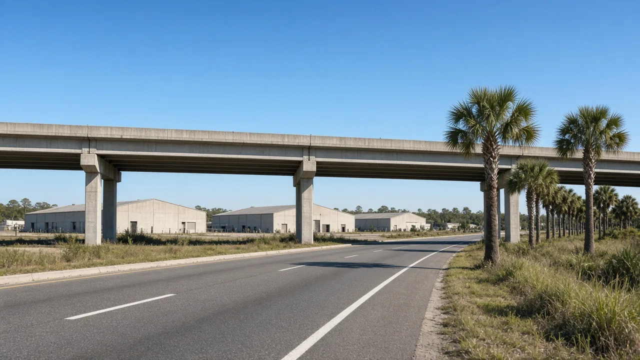
Project 443316-1-52-01 added a second left-turn lane on the westbound I-4 ramp to Park Road, Exit 22. The project page says all construction activities were completed on Monday, August 31, 2026. The limits are the westbound I-4 ramp at Exit 22 to Park Boulevard. The page is archived as a completed interchange improvement in Plant City. A second left-turn lane is a ramp. It is not a store.
Project 451041-1-52-01 is landscape at the I-4 interchange with SR 553, Park Road. The page says work started June 22, 2026, the construction cost is $993,297, the contractor is Midwestern Construction, Inc., and completion is expected in summer 2027. The work is landscape in the medians and interchange infields. The page listed no closures at the time it was read for this briefing. Landscape in an infield is not a commercial building permit.
Project 456967-1-52-01 is the widening. It is in design. The limits are I-4 from I-75 to west of the Polk Parkway, 17 miles, through Dover, Mango, Plant City, Seffner, and Tampa. The page says the project will widen I-4 along the median to add one buffer-separated express lane in each direction, and that the I-4 bridges over McIntosh Road, Branch Forbes Road, Thonotosassa Road, Alexander Street, Paul Buckman Highway / Wheeler Street, Park Road, and Charlie Taylor Road will be widened. The page also lists retaining walls, noise barriers, tolling equipment, signing, pavement markings, and intelligent transportation systems. Construction is currently anticipated to begin in 2028. The design page spells the north-south highway “Buckman.” The comprehensive plan spells it “Buchman.” Carry both spellings back to the page that printed them. An anticipated construction year is not a notice to proceed.
The study underneath that design is FDOT District 7’s I-4 Project Development and Environment study from east of 50th Street to the Polk Parkway, SR 570. The study page describes 22.1 miles of express toll lanes and says I-4 eastbound from Tampa is one of seven one-way evacuation routes in Florida. I-4 is on the state’s Strategic Intermodal System. A public hearing for that study was held October 19, 2015, with documents on display from September 28 through October 29, 2015. The hearing record includes a presentation video on the District 7 study site. It is a 2015 corridor hearing. It is not the August 31, 2026 ramp completion, and it is not a 2028 groundbreaking.
Use the video for the express-lane concept the department took to that hearing. Use the February 19, 2026 traffic report for the 2025 volumes. Use the three project pages for what has been built, what is being landscaped, and what is still in design. Four vintages, four jobs.
How to use this on a bay, a dock, a storefront, or a nearby house
For a retail or service user, start with the node. The plan’s three activity centers are Alexander at James L. Redman, I-4 at Thonotosassa, and I-4 at Park Road. Downtown Collins and Reynolds is the historic center, with computed counts in the 5,300 to 7,300 range on Collins and a one-way Baker Street count of 13,000 between Alexander and Palm. Park Road’s computed count north of I-4 is 25,500. A Brandon boulevard comp belongs on the State Road 60 guide. A Wiregrass pad belongs on the Wiregrass guide. Plant City’s intensity for ordinary commercial is 0.35 FAR, and 1.0 FAR only in the quarter-mile interstate condition the plan printed. Retail is the service layer when the question is a specific bay. Office is the layer when the question is a professional suite, including the hospital overlay along Alexander, Reynolds, and Baker.
For an industrial or flex user, the plan’s forward land is Gregg’s / Lakeside, about 1,370 acres in one section and about 1,300 in another, south of U.S. 92 and east of Park Road, plus County Line Road south of I-4. The intensity is 0.50 FAR, and convenience commercial inside an industrial planned development is capped at 10 percent of the industrial square footage. The plan’s “to date” sentence is over 1,000,000 square feet of light industrial already built, with the rest expected by 2040. The airport industrial park to the southwest is the area the plan calls near build-out. Industrial is the service layer. The port and I-4 industrial guide is the belt west of here. A dock door still needs a truck path, a zoning determination, and a user who can occupy it. The 11.9 truck factor on the Bethlehem Road interstate count is a highway classification factor. It is not a loading-dock appointment.
For a land buyer, the entitlement path is the comprehensive-plan category first and the zoning district second. Ask for the future-land-use category, the zoning, and whether the site is inside a quarter mile of an arterial intersection with I-4, inside a third of a mile of an interchange on a local road that would have to be improved, inside Midtown, inside the Northeast master plan, or inside the hospital overlay. LU Policy 7.1.4 tells the city to use infill, the Midtown vision, the Northeast master plan, and mixed-use categories in map amendments, rezonings, and site plans. A planned-development rezoning is the ordinary path in the Northeast study area for parcels that are not on the small-lot exemption. Commercial investment is the service layer when the question is an income property. Commercial buying is the layer when the question is a specific building. The city’s planning department, at the number printed on its own pages, is who looks up the designation. A zoning determination letter is a city product. This briefing is not that letter.
For a lender, the July SLOOS briefing is the national credit tape on construction, land development, and income property. A Plant City future-land-use category does not change that survey. It can change the entitlement path in front of a vertical building. The house-rate tape next to a user who borrows on a residence is separate again. The latest weekly survey on this site is the Freddie Mac print at 7.03 percent. A commercial coupon is not that survey. A payment on a house still starts with a written quote on the mortgage page.
For a house on a street that feeds one of these corridors, price the house against current comps of the same street type. The Brandon and Valrico home guide is the suburb to the west. The Hillsborough residential overview is the county file. The QuickFacts owner-occupied value of $291,800 is a 2020–2024 citywide ACS figure. It is not a Plant City list price, and the pricing guide is the process. The plan says future rooftops concentrate north of I-4, and that commercial nodes are supposed to serve them without sending non-residential traffic through the neighborhood. A hearing, a ramp lane, or a landscape project can change what a buyer asks. It does not, by itself, set the contract. Flood and insurance stay on the parcel. When a lender orders a value, that file is an appraisal.
The Citrus commercial files a reader may already have open are a different county. Black Diamond Town Center is the Lecanto subdivision the Citrus applications list already calls under construction. The CR-486 interchange map is a Citrus comprehensive-plan hearing set for October 26, 2026. Plant City’s Imagine 2040 plan is adopted. Its Park Road ramp improvement is complete. Its I-4 express-lane widening is in design, with construction anticipated in 2028. Three counties, three clocks.
The through-line
Plant City’s adopted comprehensive plan puts further retail and service commercial growth at three activity centers: Alexander Street and James L. Redman Parkway, the I-4 interchange at Thonotosassa Road, and the I-4 interchange at Park Road. It places the next industrial land at Gregg’s Business Center / Lakeside Station, east of Park Road and south of U.S. 92, and along County Line Road. Ordinary commercial intensity is 0.35 FAR. The plan allows 1.0 FAR for general commercial within a quarter mile of an arterial intersection with I-4, and the C-2 code leaves downtown core without a maximum FAR. Industrial intensity is 0.50 FAR. Downtown Collins is a few thousand vehicles a day. Park Road north of I-4 is 25,500, computed, in the 2025 report. I-4 under Bethlehem Road is 144,159, computed, on a telemetered station. The westbound Park Road ramp gained a second left-turn lane, finished August 31, 2026. Landscape at that interchange is underway, at a construction cost of $993,297, toward summer 2027. The 17-mile express-lane widening is in design, with construction anticipated in 2028. Census counts 44,118 people on July 1, 2025. BEBR counts 45,331 on April 1, 2025. The plan’s 2014 table still points at 71,523 in 2040. If you are underwriting a bay, a dock, or a storefront in this city, use the node, the FAR, the station number, and the project page — and leave the rent, the cap rate, and the absorption rate unwritten, because none of those official papers printed one.
Sources: Hillsborough County City-County Planning Commission, Imagine 2040 Plant City Comprehensive Plan, Adopted 2040 Plant City Plan, including the vision-map narrative, LU Table 2 population projections sourced to the Planning Commission in 2014, the land inventory (commercial 769 acres at 0 to 0.35 FAR; industrial 1,678 acres at 0 to 0.50 FAR), the commercial category bullets on 0.35 FAR and 1.0 FAR within a quarter mile of arterial intersections with I-4, the industrial definition at 0.50 FAR with convenience commercial limited to 10 percent of industrial square footage, the Gregg’s Business Center / Lakeside Station description (about 1,370 acres, and about 1,300 acres in the vacant-land paragraph; over 1,000,000 square feet of light industrial “to date”), LU Policies 1.3.2, 2.1.4, 2.4.1, and 7.6.7, the Northeast Plant City Area Master Plan village-center and Jim Johnson / East Park Road standards, and the Midtown vision plan adopted in 2007. City of Plant City, planning and zoning resources and the Live Local Act district list. Plant City Code of Ordinances, Chapter 102, including C-2 sections 102-617 and 102-620 and the M-1 floor-area ratio of 50 percent. U.S. Census Bureau, QuickFacts, Plant City city, Florida, V2025, and the 2020–2024 ACS lines on that table. University of Florida BEBR, Florida Estimates of Population, April 1, 2025, Plant City 45,331 and Hillsborough County 1,575,637. Florida Department of Transportation, 2025 Annual Average Daily Traffic Report, county 10 Hillsborough, file 7_10, run February 19, 2026, including site 9962 and the Park Road, Alexander, Collins, Buchman, Thonotosassa, and ramp sites cited above. FDOT District 7 project pages 443316-1-52-01, 451041-1-52-01, and 456967-1-52-01, and the I-4 PD&E study from east of 50th Street to the Polk Parkway, including the October 19, 2015 public-hearing presentation. The July 2026 SLOOS and the Freddie Mac survey for the week of the 7.03 percent print are cited only as separate national tapes.
For help reading a Plant City parcel against this plan and this traffic file — or a property in Hillsborough, Pasco, Pinellas, Hernando, or Citrus — contact Bridge Point Business & Real Estate Advisors at 352-515-0226 or request a consultation.
Questions people ask first
Quick answers to common questions about this topic.
Where does Plant City’s comprehensive plan put commercial growth?
The adopted Imagine 2040 plan directs further retail and service commercial development to three activity centers: the intersection of Alexander Street and James L. Redman Parkway, and the Interstate 4 interchanges at Thonotosassa Road and Park Road. It also describes highway commercial at the I-4 interchanges of Alexander Street, Paul Buchman Highway and Wheeler Street, and County Line Road. Downtown Collins and Reynolds remains the historic center.
Where does the plan put industrial land?
The industrial park around Plant City Airport is described as near build-out. Additional industrial uses are planned for Gregg’s Business Center, also called Lakeside Station Logistics Park, south of U.S. 92 and east of Park Road, and along County Line Road south of I-4. One section sizes that district at about 1,370 acres. A later paragraph says about 1,300 acres. The plan says over 1,000,000 square feet of light industrial uses had been built as of the plan’s own text, with the remainder expected by 2040.
What floor-area ratio applies to commercial property?
The commercial future-land-use category allows general commercial intensity up to 0.35 FAR, and up to 1.0 FAR within a quarter mile of intersections of arterials and Interstate 4. Residential density in that category is up to 16 dwellings per gross acre, or 20 in the Midtown Redevelopment District. In the C-2 zoning district, the code sets a 35 percent maximum FAR in COMM areas and no maximum FAR in the downtown core. Industrial intensity in the plan and in the M-1 code section is 0.50, or 50 percent.
How many people live in Plant City on the official estimates?
Census QuickFacts V2025 estimates 44,118 on July 1, 2025, up 10.7 percent from an estimates base of 39,859. The April 1, 2020 Census count is 39,764. BEBR’s April 1, 2025 estimate is 45,331. The comprehensive plan’s 2014 table projects 71,523 in 2040 and had projected 49,740 for 2025. Those are different vintages. The ACS 2020–2024 median owner-occupied value on QuickFacts is $291,800, which is a house value, not a commercial price.
What did FDOT count on I-4 and Park Road in 2025?
The February 19, 2026 Hillsborough report shows a computed telemetered count of 144,159 vehicles a day on I-4 under the Bethlehem Road overpass, 72,183 eastbound and 71,976 westbound. Park Road north of I-4 is 25,500, computed. Park Road south of I-4 is 27,500, a second-year estimate. Several I-4 segments closer to the city are printed with an unknown flag, including 135,000 between Alexander Street and SR 39 and 154,000 west of Park Road. Use the flag with the number.
What road work is underway at the Park Road interchange?
FDOT project 443316-1-52-01, a second left-turn lane on the westbound I-4 ramp to Park Road at Exit 22, was completed on August 31, 2026. Landscape project 451041-1-52-01 started June 22, 2026, at a construction cost of $993,297, with completion expected in summer 2027. The 17-mile I-4 express-lane widening, project 456967-1-52-01, is in design, and the page says construction is anticipated to begin in 2028.
Does this briefing mean a named commercial subdivision has broken ground?
The completed and active FDOT work cited here is a ramp lane finished August 31, 2026, landscape in the interchange through summer 2027, and a widening still in design. Lakeside Station and the Northeast village center are adopted land-use standards in the comprehensive plan. A construction status for a named commercial subdivision would be a separate city applications paper.
Should a Plant City storefront be priced like Brandon or Wiregrass?
Price it on the Plant City node. Brandon is the I-75 and State Road 60 file. Wiregrass is the Wesley Chapel node. Plant City is the incorporated city on I-4, with a historic downtown, three plan-designated activity centers, and industrial land east of Park Road. Underwrite the node, the future-land-use category, and the FDOT station. These documents do not print a cap rate or a vacancy rate.
Talk with Bridge Point
Considering a purchase or sale in this market? Local guidance can make a meaningful difference.
Schedule a consultation
