
Local Market Guide · 17 min read
Homes for Sale in Cala Hills, Ocala, Start on SW 20th Court. Tract J Is Still Vacant.
Marion County’s roll lists 65 addressed cards in Cala Hills Phase 1 Part A, 50 of them on SW 20th Court in Ocala, tax district 1001. Forty of those cards carry homestead codes. The City Council approved 104 townhomes on Tract J, 26.03 acres, and the 2026 card for that tract still shows buildings of $0.

Homes for sale in Cala Hills, Ocala, sit on a city subdivision the property appraiser indexes as Cala Hills Phase 1 Part A. That index returns 68 cards. 65 of them have a street address: 50 on SW 20th Court, 12 on SW 20th Terrace, 2 on SW 24th Place, and 1 on SW 21st Circle. The other three cards are the homeowners’ association common area, a City of Ocala card tagged CCN #270, and a second City of Ocala card. The tax-district code on the house cards opened for this note is 1001 - Ocala.
Cala Hills is the southwest Ocala subdivision in that index. Hills of Ocala is a different place: a Marion County municipal service taxing unit at Rolling Hills, with its clubhouse at 10475 SW 136th Terrace in Dunnellon, and the appraiser’s tax-district list prints it as 5072 Hills of Ocala.
The unfinished piece has its own file. On June 21, 2022, the Ocala City Council adopted Ordinance 2022-61, rezoning Tract J of the Cala Hills master plan from PUD to PD, and adopted Resolution 2022-39 for the planned-development plan and standards book. The tract is 26.03 acres, about 150 feet northwest of SW 21st Circle and SW 20th Avenue, parcel 23559-010-00. The plan is 104 attached townhomes. The 2026 property record card for that parcel still prints buildings of $0.
Statewide context stays on Florida markets. Marion’s April 1, 2025 population count is the separate briefing, 433,765. A purchase or a sale sits on residential.
Phase 1 is a court, not a listing sheet
The Marion County Property Appraiser, Jimmy H. Cowan, Jr., CFA, keeps the subdivision index at 501 SE 25th Avenue in Ocala. A search of that index for the subdivision name Cala Hills returns six names: Cala Hills Business Center, Cala Hills Phase 1 Part A, Cala Hills Professional Centre Condominiums, Cala Hills Professional Park Phase I, Cala Hills Professional Park Phase II, and Cala Hills Professional Park Phase II Condominium. The houses are the Phase 1 Part A line, parent parcel 2357-000-000.
The Phase 1 listing marks 40 of the addressed cards with an H and 25 with an I. Those letters are flags on the listing, not part of a last name. The appraiser’s exemption-code list prints code 01 as homestead and code 38 as the additional $25,000 exemption that does not apply to the school levy. A buyer counting “homes for sale” from this roll is counting cards, not a current inventory of listings. The roll does not say which of the 65 addresses is on the market this week.
The streets are tight. Fifty of the addressed cards are on SW 20th Court. Twelve are on SW 20th Terrace. Two are on SW 24th Place. One is on SW 21st Circle, which is also the collector the Tract J standards book uses for access. Lot sizes on the two cards opened below are 0.06 acres and 0.05 acres. A tenth of an acre is 4,356 square feet, so these are small city lots, and the card’s acre line is the figure to use for the parcel in front of you.
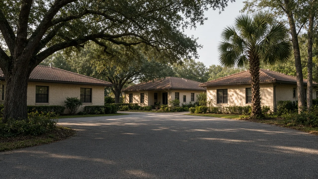
Two doors on SW 20th Court
The 2027 property record card for parcel 2357-001-001, situs 2302 SW 20th Court, Ocala 34471, is one of the H cards. Property class 01 is the appraiser’s code for improved residential, single family. Year built is 1988. Acres are 0.06. Land just value is $80,000. Buildings are $112,109. Miscellaneous improvements are $857. Total just value is $192,966. Total assessed value is $96,455. The card prints an impact of $96,511, which is the gap between just and assessed. The appraiser’s value help describes that gap as market value minus Amendment 10 holdings or an agricultural classification. Exemptions are $51,411, exemption codes 01 and 38. Total taxable value is $45,044. School taxable value is $71,455. The taxes and assessments line prints $1,216.03. The millage field prints the district code 1001 - Ocala. That field is the district, not a levy of 1,001 mills.
The next door, parcel 2357-001-002, situs 2304 SW 20th Court, is one of the I cards. It is also property class 01, also built in 1988, on 0.05 acres, in the same district 1001. Land just value is $80,000. Buildings are $103,169. Miscellaneous improvements are $868. Total just value is $184,037. Assessed value is $170,100. Impact is $13,937. Exemptions are $0. Taxable value is $170,100. School taxable value is $184,037, equal to the just value on this card. Taxes and assessments print $3,154.12.
The two tax lines differ by $1,938.09. Same court, same year built, same district code, and a homestead card beside a card with no exemption. A shopper who prices these houses from the tax bill, or from the just value, is mixing three different numbers the appraiser prints on purpose. Just value is the market figure on the card. Assessed value is that figure after the impact the help file describes. Taxable value is assessed value after exemptions. The November 3, 2026 ballot question on the homestead exemption and the non-homestead assessment cap is a separate file, Amendment 3. It is not a line already printed on these 2027 cards.
These two cards are examples, not a median and not a list price. The Phase 1 index was not totaled into an average just value for this note. A buyer or a seller uses the card for the parcel under contract. The office phone is 352-368-8300.
Tract J is the 104-townhome file
Case PD21-44453 is the planned-development file for Tract J. The May 9, 2022 staff report, written by project planner Aubrey Hale, names the applicant as Pigeon Ardurra and the property owner as Cala Hills Investments Group. The report’s parcel line is 23559-010-00. Acreage is +26.03 acres. Existing use is undeveloped. The location line is Tract J of the Cala Hills master plan, approximately 150 feet northwest of the intersection of SW 21st Circle and SW 20th Avenue.
The staff report’s background is the part a buyer should read before treating “Cala Hills” as one finished neighborhood.
- The property is part of the Cala Hills master planned development and is identified as Tract J. The PUD received conceptual plan approval and never completed final PUD plans.
- The master plan permits a total of up to 264 multi-family condos with a proposed density of 10.4 dwelling units per acre.
- Because the PUD district was inactive, the applicant had to rezone to PD, Planned Development, to create an active zoning district.
- The applicant proposes 104 townhome dwelling units, a mix of one-story and two-story models. The report states the proposed density as 4 dwelling units per acre.
- Neighborhood land use permits a maximum of 5 dwelling units per acre for single-family dwellings, or a maximum of 12 dwelling units per acre for multi-family.
Four units an acre on 26.03 acres is the staff report’s own density sentence. Dividing 104 by 26.03 is 3.995, which is the arithmetic behind that sentence. The 264-unit and 10.4-per-acre figures are the master-plan ceiling the report prints. They are not the plan the council adopted for this tract. The adopted plan is 104 townhomes.
Adjacent land, in the same report: north is public land use, PUD, described as DRA, amenity area. West is public and low intensity, governmental use, Scott Springs and multi-family. South and east are neighborhood land use, PUD, single-family dwellings, with undeveloped land also noted to the south. Staff recommended approval. The basis for approval says the PD designation is eligible to implement the Neighborhood land use, and that the plan is consistent with the comprehensive plan and compatible with the surrounding area.
Ordinance 2022-61 was adopted on June 21, 2022. The Legistar record shows the motion by Barry Mansfield, seconded by Jay A. Musleh, with a pass flag. Resolution 2022-39, the standards book, was adopted the same day, moved by Jay A. Musleh and seconded by Kristen M. Dreyer, also a pass. The history rows do not print a numeric tally. The record that is in hand is adoption, not a reconstructed vote count.
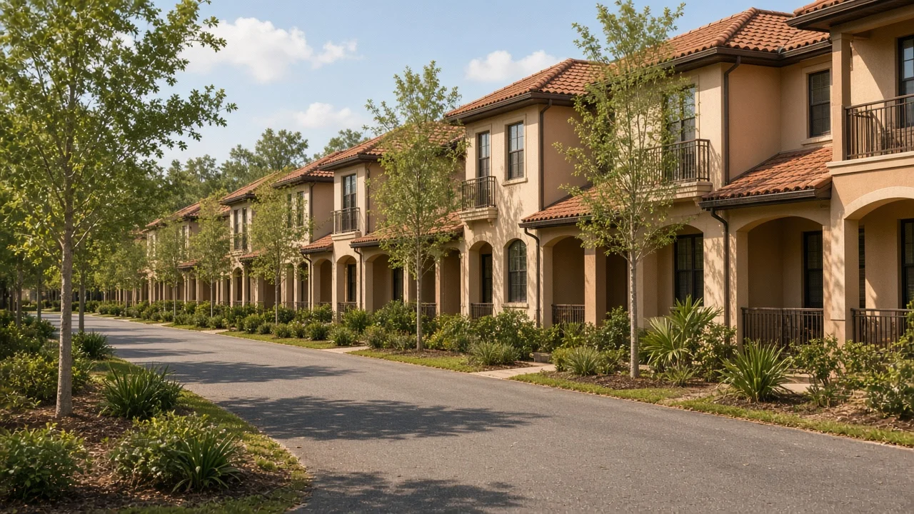
The standards book sets the lots
The planned-development standards book is dated August 2021 and revised February 2022. It was prepared for Cala Hills Investment Group, Ltd., Post Office Box 5130, Ocala, FL 34478-5130, by the project numbered 20-474.01. The introduction calls Tract J a planned development of approximately 26 acres inside the Cala Hills subdivision, west of SW 21st Circle, and inside the original Cala Hills development of regional impact. That DRI sentence, in the book, is the mix around the houses: medical and office areas, retail, recreation, and residential buildings that are both attached and detached.
Table 1 in the book splits the buildout into two phases.
- Phase 1: 35 units, 2.81 acres of residential lot area, about 100,000 square feet of floor area, 8.90 acres of open space, 3.82 acres of roads and other non-open-space area, on 15.53 acres.
- Phase 2: 69 units, 5.03 acres of residential lot area, about 200,000 square feet of floor area, 3.37 acres of open space, 1.56 acres of roads and other area, on 10.55 acres.
- Total: 104 units, about 300,000 square feet of floor area, 12.27 acres of open space, 5.91 acres of roads and other area, 26.02 acres.
The book says floor areas may vary with final design, the Florida Building Code, and buyer preferences, and that open space includes green space next to the units. Twelve and twenty-seven hundredths acres of open space on 26.02 acres is 47.2 percent. The conceptual plan sheet states a minimum of 40 percent open space, 10.41 acres, and recreation facilities, including pedestrian and bicycle paths, at a minimum of 10 percent of open space, 1.04 acres. The table’s 12.27 acres is above that minimum. The sheet’s 1.04 acres is 10 percent of the minimum, not 10 percent of 12.27.
Table 2 sets the lot. Minimum lot size is 2,632 square feet. Minimum width is 28 feet. Front setback is 20 feet. Side setback is zero. Rear setback is 10 feet. A corner lot’s side yard against a public or private street is 15 feet. Every lot fronts the Tract J roadway. No lot takes frontage on an adjoining parcel or street. Building height is limited to two stories and 35 feet at the highest roof peak. The book compares the zero-side-yard lots with the city’s residential zero-lot-line district, and it points to nearby Cala Hills Tract F as the similar pattern already in the community.
Parking on the conceptual sheet is two spaces per unit, 208 spaces for 104 units. The standards book adds that those spaces are designed as a two-vehicle garage, with driveway room for at least one more vehicle outside the unit, and pull-off spaces at the mailbox. The trip-generation table uses ITE code 215, single-family attached townhomes: a rate of 7.2 daily trips, printed total 749, and a p.m. peak rate of 0.57, printed total 59. The staff report says a project under 100 p.m. peak-hour trips submits a traffic impact statement rather than a full traffic study, and that this plan generates fewer than 100. The same report places the site about 2,000 feet from SW 19th Avenue Road. The conceptual plan’s vicinity map labels Easy St, SW 17th Street, and SW 27th Avenue around the subject property.
Water and sewer are available, in the staff report’s level-of-service lines. Stormwater for future development has to be retained on site to match pre-development conditions, designed for a 100-year, 24-hour storm, citing the comprehensive plan’s stormwater policy. Solid waste and fire service are listed as available. New utilities are to go underground where practical. The book says each unit is individually metered, on city sewer, city water, and city electric.
Amenities in the book are pedestrian walkways, bicycle parking, and a bench or similar seat at least every 400 feet of walkway. It also says this part of Cala Hills will have access to the adjacent Cala Hills community center, sports courts, and walkways, and controlled access to Scott Springs Park as the city may allow. Residents are required to join the homeowners’ association that maintains the common areas. The book does not print a dollar amount for that association.
The book’s own schedule sentence: development will take time and several years, in at least two phases, and individual buildings depend on the economy and market conditions. That sentence is from the standards book adopted in 2022. It is not a construction calendar for October 2026.
The 2026 card still shows vacant land
The 2026 property record card for parcel 23559-010-00, prime key 2823054, is the Tract J card. The owner line is Cala Hills Investments Group, Post Office Box 5130, Ocala 34478-5130, which matches the standards book’s mailing address and is one word off the staff report’s “Investments Group” versus the book’s “Investment Group, Ltd.” Acres print as 26.03. Property class is 10. On the appraiser’s real-estate class list, codes 10 through 39 are commercial, and code 10 is vacant commercial. Buildings are $0. The 2025 certified value block, and the 2026 history row, both print land just value $571,250, assessed value $571,250, exemptions $0, and taxable value $571,250. The 2025 history row prints the same just value and an assessed value of $557,750. The taxes line on this card is blank. Dividing $571,250 by 26.03 acres is about $21,946 an acre. That is arithmetic on the card’s just value. It is not a sale price and not a finished-townhome price.
The land lines on the same card print zoning PD03. One line is use 1000 and 19.03 acres. One line is use 9600 and 7.00 acres. Those two acre lines add to 26.03. A third line is use 9994 and 1.00 UT, which is a unit line, not a third acreage to add. Ordinance 2022-61 rezoned the tract from PUD to PD. The card’s zoning abbreviation still reads PD03. A buyer reading the card and the ordinance side by side is looking at an assessment record and a zoning ordinance that have not been edited into one sentence.
On September 5, 2023, the City Council approved the Cala Hills Tract J conceptual subdivision plan, SUB23-45110. The Legistar history marks that item as consent, moved by Barry Mansfield and seconded by Kristen M. Dreyer, and passed. The Planning and Zoning Commission had approved the same conceptual plan on August 14, 2023, moved by Todd Rudnianyn and seconded by Arthur “Rus” Adams. The minutes note says the motion carried by roll call. The tally is not in the history row.
A conceptual plan and a final plat answer different questions. The 2026 card, with class 10 and buildings of $0, is the assessment picture of one parent parcel. It does not show 104 separate townhome folios.
The city engineer’s July 2023 memo
Sean Lanier, P.E., CFM, city engineer, wrote the Planning and Zoning Commission on July 27, 2023, about SUB23-45110. The memo repeats the program: 104 single-family attached townhomes on 26.02 acres, PD zoning, two phases, 35 lots then 69, minimum lots 28 feet wide and 2,632 square feet, setbacks 20 feet front, zero side, and 10 feet rear. The plan was prepared by Pigeon-Ardurra, LLC. The developer is Cala Hills Investment Group, LTD.
Roadways are proposed at 30 feet, with 10-foot easements on both sides and pavement of 24 feet. Sidewalks go on both sides of the internal streets. Roads and the drainage system are privately maintained by the homeowners’ association. Potable water and sanitary sewer are proposed for public maintenance after the standard one-year maintenance period. A residential sanitation fee, printed as currently $265.00 per lot, is due at the final plat of each phase. The engineer’s office recommended approval.
Using that 2023 per-lot figure on the lot counts in the same memo: 35 times $265 is $9,275, and 69 times $265 is $18,285, which is $27,560 for 104 lots. The memo’s word is “currently.” The arithmetic is the printed fee times the printed lots. It is not an invoice, and it is not evidence that a final plat has been recorded. The fee is collected at final plat. The parent card described above is still one vacant parcel.
Scott Springs is the park on the west side
The City of Ocala’s park page for Scott Springs lists 21.68 acres at 2825 SW 24th Avenue, Ocala 34471. Amenities on that page include a bike trail, exercise equipment, hiking trails, a lake, pond, or spring, a pavilion, picnic tables, playground equipment, restrooms, and water fountains. The walking-trails table lists the Scott Springs Health Trail at the same address as three-quarters of a mile, sunrise to sunset, with exercise equipment. City parks are open sunrise to sunset, except lighted courts and fields, which close at 10 p.m. The parks FAQ states there is no swimming at Scott Springs or at any city park. Recreation and Parks is at 828 NE 8th Avenue, 352-368-5517. The park-ranger line for a problem in the park is 352-789-1133.
The staff report places Scott Springs on the west side of Tract J, in the same direction as multi-family. The standards book’s trail language is access “as may be allowed by the City of Ocala.” A path drawn on a conceptual plan is not a recorded public easement across the park fence. The park’s own hours and the no-swimming rule are the rules that are posted.

The 2022 school note named three schools
The May 9, 2022 staff report’s school line is specific, and it is dated. It says the impacted schools are experiencing localized overcrowding at Saddlewood Elementary, Liberty Middle, and West Port High. It estimates the development would add 10 elementary students, 4 middle-school students, and 4 high-school students. That is an estimate attached to 104 townhomes in a 2022 staff report. It is not an October 2026 enrollment count, and it is not a school assignment for every address already built on SW 20th Court.
Marion County Public Schools assigns a student by the residential address of the parent or legal guardian. The district’s page for finding a zoned school points families to MySchoolLocator for the 2026–2027 year. The Student Enrollment Office is at 1614 E. Fort King Street, Ocala 34471, 8:00 a.m. to 4:30 p.m. weekdays, 352-671-7743. The district’s boundary-map note says a buyer who is purchasing a house for a school zone should ask Student Assignment and Records, 352-671-7747, for written confirmation. The district’s opening projection of 46,697 students, and South Marion High’s opening capacity of 2,011, are the separate southwest-county file at South Marion High. That campus is near Marion Oaks. The appraiser’s tax-district list prints Marion Oaks as 8002. District 8002 is not district 1001.
Office plats share the name
The same subdivision search that returns Phase 1 also returns the business center and the professional-park plats. Those are commercial and condominium names in the index. A medical office or a shop under a Cala Hills professional-park name is a different parcel class from property class 01 on SW 20th Court. The standards book’s description of the old development of regional impact is the reason the names sit together: the original plan included medical, office, retail, and recreation as well as houses. Sharing the words Cala Hills does not put a professional-centre condominium on the same card as a 1988 single-family house.
Sunbiz lists Cala Hills Master Association, Inc., document N27025, as active, and Cala Hills Investment Group, Ltd., document A95000000239, as active. The Phase 1 common-area card, parcel 2357-000-000, is in the name of Cala Hills One Homeowners Association. The Tract J book says buyers in that project join the association that maintains its common areas. Those are three different captions. The deed, the association documents, and the plat, when a plat exists, are the papers that say which association a particular lot joins. The corporate list does not set the dues. No dues figure is in the city file used here.
The other Ocala maps
Hills of Ocala is the MSTU the county describes as more than 5,100 lots, created by a referendum in 1983, with a current millage of 0.18. The advisory board meets at the clubhouse on SW 136th Terrace in Dunnellon. Rolling Hills Units 1-A through 5 are the subdivision names that appear when a search is loose enough to catch the word Hills. They are not Phase 1 Part A, and they are not Tract J.
Marion Oaks is the other southwest growth pocket, the one the school district attached to South Marion High. August housing authorizations for the Ocala metropolitan area, which is Marion County in that table, were 362 units, 342 of them one-unit, in the August permits briefing. That metro total is not a Cala Hills permit count. The Interstate 75 auxiliary-lane job from State Road 200 to State Road 326 is a separate construction calendar, FPID 452074-1. The horse-farm inventory, 23,928 horses on Marion farms, is the farm grid, not this court.
The Ocala metropolitan unemployment rate in the August 2026 release was 5.7 percent, not seasonally adjusted, in the metro unemployment note. Ocala the city, on the April 1, 2025 estimates, is 71,017 people inside a county of 433,765. Unincorporated Marion is the large share. A house in tax district 1001 is on the city side of that split.
What a buyer checks before an offer
A house already standing on SW 20th Court is a 1988-era single-family card in district 1001, with its own just value, assessed value, exemption codes, and tax line. The two doors above are the illustration: $192,966 just value and $1,216.03 in taxes on the homestead card, and $184,037 just value and $3,154.12 in taxes on the card with no exemption. Neither figure is an asking price. The weekly mortgage survey is a third number. Freddie Mac’s October 8, 2026 average was 7.40 percent on the 30-year, and the published principal-and-interest figure on a $300,000 loan at that rate is $2,077.14 a month, in the October 8 survey note. Half of that loan, $150,000, is $1,038.57 a month, because the payment scales with the principal. That illustration is not a Cala Hills sale and not a quote.
A townhome that does not yet have its own folio is still inside parcel 23559-010-00 until a plat and a split say otherwise. The adopted counts are 104 units, 35 then 69, lots at least 28 by the minimum area of 2,632 square feet, two stories, 35 feet. Growth Management for the City of Ocala is at 201 SE 3rd Street, second floor. The zoning phone is 352-629-8404. The building phone is 352-629-8421.
Bridge Point reads the card, the ordinance, and the school-assignment letter with you before an offer. Call 352-515-0226 or start at contact.
Questions people ask first
Quick answers to common questions about this topic.
Where are homes for sale in Cala Hills, Ocala?
The property appraiser indexes the houses as Cala Hills Phase 1 Part A. Of 65 addressed cards, 50 are on SW 20th Court, 12 are on SW 20th Terrace, 2 are on SW 24th Place, and 1 is on SW 21st Circle, in tax district 1001, City of Ocala. The roll does not say which addresses are listed for sale.
How many Cala Hills Phase 1 cards have homestead exemption?
The Phase 1 listing marks 40 addressed cards with an H and 25 with an I. On the 2027 card for 2302 SW 20th Court, parcel 2357-001-001, the exemptions are $51,411 under codes 01 and 38, which the appraiser lists as homestead and the additional $25,000 that does not apply to the school levy. The next door, 2304 SW 20th Court, prints exemptions of $0.
Did Ocala approve 104 townhomes at Cala Hills?
Yes. On June 21, 2022 the City Council adopted Ordinance 2022-61 and Resolution 2022-39 for Tract J, parcel 23559-010-00, about 26.03 acres, case PD21-44453. The plan is 104 townhomes in phases of 35 and 69. On September 5, 2023 the council approved conceptual subdivision plan SUB23-45110.
Are the Tract J townhomes built?
The 2026 property record card for parcel 23559-010-00 prints property class 10, vacant commercial, buildings of $0, and a just value of $571,250 on 26.03 acres. The adopted plan is not a set of separate townhome folios on that card.
Which schools did the city name for Tract J?
The May 9, 2022 staff report named Saddlewood Elementary, Liberty Middle, and West Port High, and estimated 10 elementary students, 4 middle-school students, and 4 high-school students from the 104 townhomes. Current assignment is by address through Marion County Public Schools, 352-671-7747 for written confirmation.
Talk with Bridge Point
Considering a purchase or sale in this market? Local guidance can make a meaningful difference.
Schedule a consultation
